vrijdag 20 december 2013

Crossing the heights of Bolivia

Finishing this blog entry, I realise that it became a very long one...
But Bolivia offers such a diversity and I hope I can share via the below stories and pictures a bit of this fascinating country!

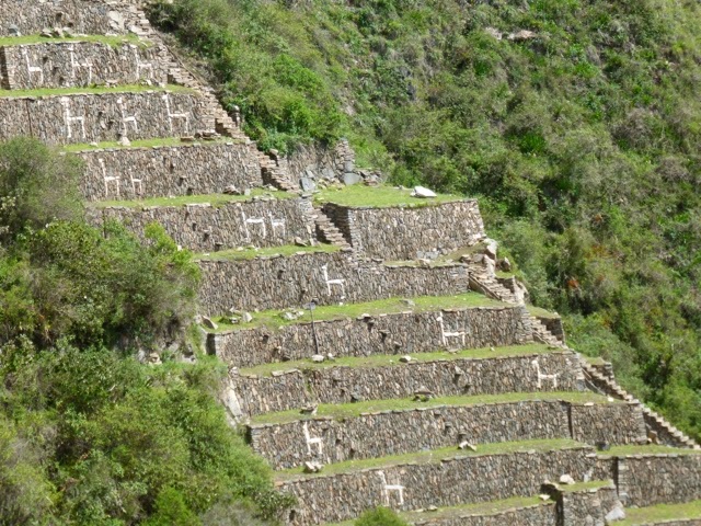
Ollantaytambo - last Peruvian supper in the Sacred Valley
I have had two great months in Peru and although there are many more places I want to visit in this country, I feel somehow ready to move on to my next destination: Bolivia! Time for a last Peruvian supper... and for this one I am invited by Dina, a Geman girl who is already working several years in Lima, to visit the family of her godchild in Ollantaytambo, a village in the Inca's Sacred Valley. It turned out to be a Pachamanca supper, a traditional dish in the Peruvian Andes. With the aid of hot stones lamb, cuy (guinea pig), potatoes, sweet potatoes and beans are baked in an oven in the earth. As a side dish you get the choclo con queso (corn and cheese) and of course some beer and inca cola. Simply delicious!!

   Opening the Pachamanca (in Quechua 'Pacha' means Earth and 'manca' means pot).

   The cuy (guinea pigs) stuffed withe herbs... looks good, no?!?

   Traditional Pachamanca in the Sacred Valley.

Lake Titicaca & Isla del Sol - crossing the border to Bolivia
Going from Peru to Bolivia is a truly nice experience, driving along the borders of Lago Titicaca, the highest navigable lake in the world (3800m above sea level). My first stop in Bolivia is Copacabana, an uninteresting little town at the shore of the lake. No wonder that the next morning I am already boarding a little boat going to Isla del Sol. This island is located in the southern part of LagoTiticaca and contains mainly nature, many Inca ruins and a few little villages... perfect for a couple of days relaxing! I cross the island by foot from south to north over the very scenic path which runs through the middle of the island. Arriving at the most northern tip I find a little hill, complete quietness, a good book (which I brought myself) and a beautiful sunset over Lago Titicaca! The next day I walk back via the coastal way and since I didn't have a shower yet, I have a swim in the lake... yes, it is cold swimming at 3800m, but refreshing!

   Crossing Isla del Sol from south to north on the very scenic road in the middle of the island.

   Multi-tasking at Isla del Sol: watching the sheep and spinning wool!

   View over Isla del Sol and Lago Titicaca from the most northern tip of the island.

   Isla del Sol, Lago Titicaca and the Cordilera Real!!

   Sunset over Lago Titicaca...

La Paz - where high is low and low is high
Saying that La Paz is a beautiful city is a bit too much, but I can definitely say that it is an extremely fascinating city! La Paz -located at 3600m- is spreading out in the valley and expanding upwards along the mountain sides... it is quite a view! In the city centre -concentrated around the Plaza San Franciso- life is tumultuous, traffic is slow and chaotic (causing lots of pollution) and walking the narrow, steep streets on which the pavements are occupied by street vendors is both entertaining and difficult. In the heart of it all you find the big market in which you can buy, eat and drink everything (there are almost no supermarkets in La Paz, the Pacenos like to buy there stuff on the market) and the area of the Witches Market, where you can find herbs, llama foetuses and other attributes used to sacrifice to the gods.
What is weird in La Paz is the obvious geographical distance between classes: while the people in El Alto - the highest part of La Paz at 4000m- are struggling to breath and to survive, the people in la Zona Sur -the lowest part around 3000m and a slightly warmer climate- are sitting cosy in their mansions surrounded by big perfectly maintained gardens. I have been crossing El Alto twice to go to climb Huyana Potosi in the Cordillera Real and it is a really poor area. Most of the houses are unfinished brick buildings without windows and of course without painting, and an incredible amount of dogs are wandering along the unpaved streets. The saying 'the sky is the limit' for sure does not apply to La Paz... the bottom is so to say the top in La Paz.
All this being said, I had a great week in this crazy city! I met the Irish lads again with whom I did the Salkantay trek to Machu Picchu, I downhilled Bolivia's famous Death Road by mountainbike (3500m downhill, from which 30km on dirt road, passing along ravines and through waterfalls), I climbed Huayna Potosi -with its 6088m one of the easier mountains in the Cordillera Blanca- but due to heavy snowfall I needed two attempts, and I simply enjoyed strolling through the city and hanging out in some of the nice bars.

   Plaza San Franciso, the heart of La Paz.

   Famous and funny for Bolivian cities: zebras are arranging the traffic!

   Llama foetuses on sale in the Witches Market. Sorry can't bring any home, customs would not agree...

   The story of Che and his assassination by the CIA in Bolivia is still very alive in the streets of La Paz!

   Calle Jaen, one of the more preserved colonial streets in La Paz.

   Evo Morales, the coca farmer who became the first indigenous president of Bolivia.

   Hanging out with the Irish lads: treating ourselves with steak and Bolivian wine.

   The untouched summit ridge of Huayna Potosi after a night of snow... William -Guillermo- Wallace, my guide, and I are the first cordee on the summit! Hard work to break trail through half a meter of fresh snow ('una nievendita de la puta'... dixit William Wallace!)

   The only other cordee who made it to the summit that day, thanks to our trail ;-)

Sucre - la ciudad blanca
Getting out of the bustling city of La Paz and arriving in Sucre is quite a change. The atmosphere here is very pleasant and relax, the perfect place to recharge my batteries after the busy week in La Paz. I spend my days sitting in the sun on one of the many squares watching people, taking some salsa classes and enjoying good food (and everything is very very cheap). For the evenings I find a cosy bar where they show movies and documentaries about Bolivia and the politics in South-America in general.
One peculiar thing about Sucre -also called la Ciudad Blanca- is that it is the official capital of Bolivia, although de facto La Paz rules the country. La Paz is the seat of the executive and legislative branches of the Bolivian government (e.g. the presidential palace is in La Paz) and the judicial branch is in Sucre. Because of this La Paz is often called the administrative capital of Bolivia.
Since Evo Morales became president in 2005 there has been a movement to return all three branches back to Sucre and reinstate Sucre as Bolivia's one and only capital. Of course the people of La Paz were naturally opposed to this and big protests and manifestations from both Pacenos and Sucrenses took place in 2008 with lots of violence... In these turbulent times president Evo Morales drafted a new Bolivian constitution, which still states "Sucre is the capital city of Bolivia", but the request to move all the government branches back to Sucre was denied. Hence, until today Sucre remains the capital of Bolivia and La Paz the seat of government...

   The 'emblem' of Bolivia on the Plaza 25 de Mayo in Sucre.

   La Prefectura on the Plaza 25 de Mayo.

   Enjoying a beer with a view over Sucre from the mirador La Recoleta.

   Also on the Plaza 25 de Mayo the text from the new constitution is clearly repeated...

   The Senate Hall in the Casa de Libertad, housing a big statue of libertador Simon Bolivar with on the right side the first two flags of Bolivia and on the left the current flag and the Wiphala, the square emblem flag representing the native people of all the Andes, introduced by Evo Morales' new constitution as the dual flag of a Bolivia along with the red, yellow and green banner.

   Sucre or la Ciudad Blanca... (you can also see the zebras arranging the traffic here as well)

   Hundreds of different sorts of potatoes on the market.

   Watching people on one of the squares in Sucre...

Potosi - the mining city
'Potosi, once the source of great wealth for colonial Spain and of incredible hardship for many Bolivians'... Huge amounts of silver were once extracted from Cerro Rico, as the mine in Potosi is called. The miners were all indigenous people working for the Spaniards.
Today, the Spaniards are gone, but Cerro Rico is still a source of incredible hardship for the 15000 miners who work daily in the mines to support their families. 'The Devil's Miner', a movie I saw in Sucre about Basilio -a 14 year old boy who works with his younger brother in the Cerro Rico mine-,  prepared me already a bit for my visit of this mine. However, crawling through the tunnels, feeling the temperature rise up to 30-40 degrees the deeper you go, breathing the dusty atmosphere, seeing the miners at work, having to jump aside when the wagons full of stones pass by... all this makes you really realise how hard the life of a miner in Potosi is! It was an incredible experience to visit this mine, but for sure not a fun tour!

   Little street in Potosi with in the background the Cerro Rico, where still 150 mines are actively in use.

   Feliz Navidad is coming... Christmas market in Potosi!

   The entrance we took into the Cerro Rico mine.

   'Safety' is a big question mark in Cerro Rico.

   Miners at work, loading a new wagon.

   Transport of the full wagon up to the hauling place.

   Miners and their practical jokes... some dynamite, a detonator and fire.


dinsdag 3 december 2013

In the footsteps of Hiram Bingham...

It is a Friday in November, 5:30am and -after a race on the hundreds of big stone stairs- we arrive with quite a bunch of people from our group first at the gate of Machu Picchu... 10 minutes later the first bus with other tourists arrives. Mission accomplished: we have beaten the first bus and are in pole-position to enter the site when they will open the gates at 6:00am! 
And hell yeah, it was worth the effort and sweat... these first 10-15 minutes in the morning walking around in an empty Machu Picchu, still covered in clouds of mist, are pure magic!! I am thinking about the last 4 beautiful days during which I have been walking the Salkantay trek with a group of about 20 like-minded people and 2 great guides; we have covered 100km and crossed a pass of 4700m to finally arrive at this truly amazing place! Machu Picchu is everything I expected and much more... The fact that slowly more and more people are walking around the site doesn't even bother me, I am just happy to be here at this stunning place! Huayna Picchu -the characteristic mountain which forms the backdrop of most Machu Picchu pictures- is the biggest part of the morning in the clouds, but when we begin to climb Huayna Picchu, the sun doubles its effort and breaks through the clouds. In some parts the climb is very steep and the stairs are very narrow, but we are rewarded with a crazy bird's-eye view of Machu Picchu and its surroundings! Just a perfect day, as Lou Reed would say...

After a weekend of rest and a Salkantay celebration party with our group back in Cusco (sorry no pictures of this, somehow they were all blurred;-) ) I am ready to hit the road again. This time I am going alone, a bag pack with food for three days, a tent and a sleeping bag... destination Choquequirao! Another Inca city discovered by Hiram Bingham in his search for the Lost Inca City. Choquequirao is also built in a stunning location high up the Andean mountains near Cusco, but there is no easy way to get there. And that's exactly why I want to go there! You need to walk for at least 1.5 days, descend 1500m in a canyon, cross the Apurimac river Indiana Jones' style by pulling yourself to the other side while sitting in a small crate, and then ascend again 1500m to reach the ruins... No need to say that there were not many tourists, in fact I was completely alone when I was visiting Choquequirao! What a big difference with the bus loads of tourists in Machu Picchu... Choquequirao is a much bigger city than Machu Picchu, but only 30% is visible, the rest is still covered in the jungle vegetation. Currently the Peruvian government is building a road towards Choquequirao and there are also plans to start building a cable car all the way up to the ruins... I am happy that I could still have the 'original experience'. Walking up to these Inca ruins, being lucky to have it all for myself and just wandering around the jungle and stumble up the different sectors of this city made it a very unique trip! Tom meets Hiram Bingham meets Indiana Jones :-)

And Indiana Jones was also my alter-ego in my very last days in Peru: I made a short trip into the Selva , the Amazonian jungle. A 5-hour boat trip on the Tambopata river brought me in the Tambopata reserve, home to many exotic birds, jaguars, tapirs, caymans, and of course all the varieties of fruit you can imagine! However, jungle stays jungle... the animals, flowers and trees are magnificent, but it is also so hot and humid and there are so many mosquitos, that I leave it to the real biologists and jungle lovers to spend more time there :-) 

Up (down) to Bolivia now!!

   The first camp site on the Salkantay trek

   Apu (mountain-mountain god) Salkantay gives me magical powers...

   Time to perform an Inca ritual on the Salkantay pass: blowing on three coca leaves in the direction of the most important apus (mountain gods) to thank them and then making a wish and placing the coca leaves under a stone you have carried up from lower in the valley.

   Day 3 of the Salkantay trek: daydreaming...

   First views of Machu Picchu early in the morning!

   Pure magic!!

   Yes, indeed, Huayna Picchu is out of the clouds!

   Happy to have some family up there as well! I received some applause from other tourists for this picture :-) Thanks 'Bende van Schelle' en 'Bende van den Donk'!

   Bird's-eye view on Machu Picchu from Huayna Picchu

   Plaza de Armas in Cusco, featuring both the Peruvian and the Inca flag.

   Also in the streets of Cusco you can still find many examples of the Inca stone work: no cement is used, the stones are cut such that they fit perfectly together... and are able to withstand earthquakes!

   On my way to Choquequirao... the long descent to the Apurimac river.

   A horse would also have been an option...

   Crossing the Apurimac river Indiana Jones'style!

   Taking in the first views of Choquequirao.

   The ruins of the Inca city Choquequirao, still for a big part covered in the jungle.

   View over the Plaza Principal of Choquequirao: unbelievable!

   Sector de llamas

   I couldn't resist...

   'Do you like my hat?' a lady asks me in Cachora, the village from where the trek to Choquequirao starts.

   Hanging out in the streets of Cachora is good fun :-)

   The newest llama fashion!

   'El Gato' lodge in the Tambopata reserve, my home for a couple of days in the jungle.

   The El Gato river in the backyard...

   Bird watching early in the morning and we are lucky to see so many Macaws.

   Obviously the Macaws are also watching on us!

   I never realised a pineapple grows from a plant and not from a tree...

   What do you do in the evening in the jungle? Go and catch Caymans! :-)